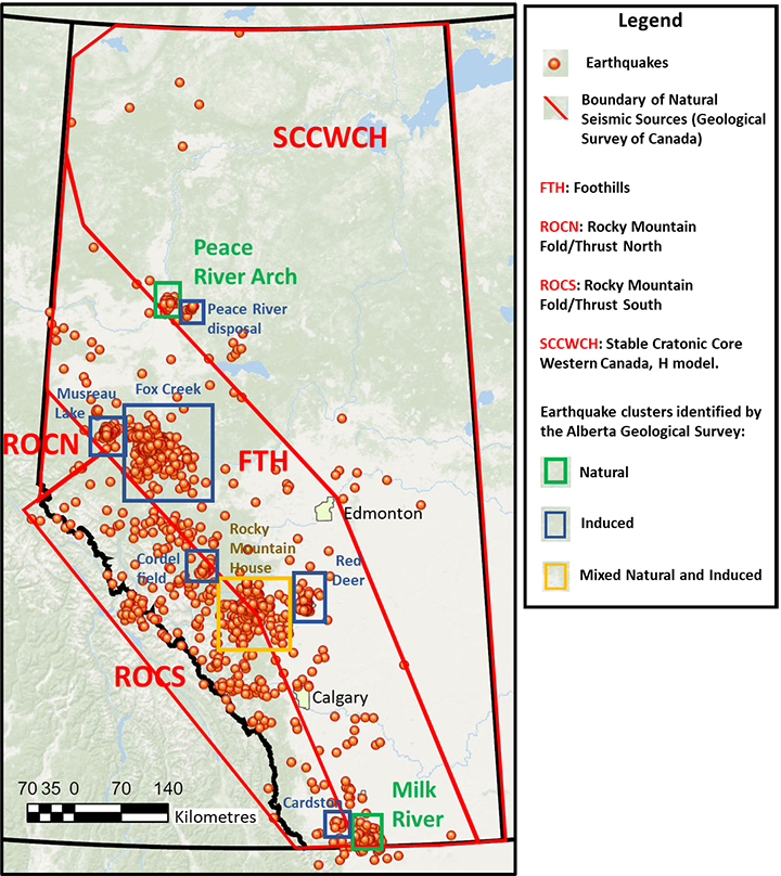
The Geological Survey of Canada identifies four natural seismic source areas in Alberta:
- Rocky Mountain Fold/Thrust North (ROCN),
- Rocky Mountain Fold/Thrust South (ROCS),
- Foothills (FTH), and
- Stable Cratonic Core Western Canada (SCCWCH).
The ROCN and ROCS cover the mountainous southwestern section of Alberta and are considered the most active natural seismic source areas in Alberta. The FTH seismic source area is a transition zone between the relatively active mountainous region and the stable midcontinent area. The SCCWCH comprises most of the northeastern section of the province; it is an area characterized by low earthquake magnitude and sparse seismicity.
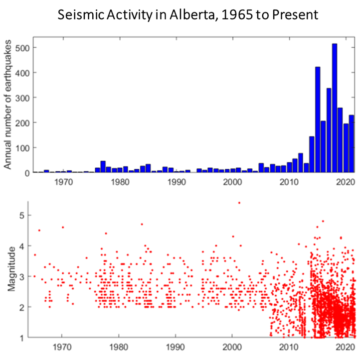
Our experts maintain a catalogue of earthquakes dating back to 2006 which we use for analyzing earthquakes and their trends in the province. By analyzing our earthquake catalogue, we identified two additional areas in Alberta where clusters of seismic events have a natural origin:
- Peace River Arch, northwestern Alberta, and
- Milk River, southern Alberta.
The Peace River Arch is a remarkable large-scale tectonic structure in the Western Canada Sedimentary Basin. The arch’s formation considerably disturbed the surrounding rocks, leaving behind major faults in the subsurface cutting the layers of rock above the arch. The geological complexity of the Peace River Arch helps explain the occurrence of seismic events in this area, which, together with the Rocky Mountains, is one of the most active natural seismic sources in Alberta. In the Milk River area, a large structural complex identified as the Sweetgrass Arch could also explain the occurrence of natural earthquakes in this area.
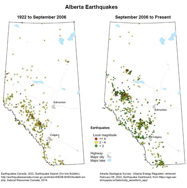
In some cases, distinguishing between natural and human-activity induced earthquakes is challenging and not always possible, therefore many of our maps and graphs include all earthquake events.


