Hydraulic Head and Salinity Mapping
Image

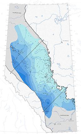
The focus of our provincial hydrogeological mapping is on systematically mapping the hydraulic head and salinity in key hydrostratigraphic units (HSU) across Alberta. We choose which HSU units to map based on future work needs related to either the base of groundwater protection (BGWP), or the deeper saline formations which could be used for water supply, disposal zones, mineral sources, or geothermal targets. We publish 2D provincial-scale PDF maps, digital data (grids and tabular data), and an interactive web application of the regional hydrogeology.
Hydrogeological Maps
Showing 5 of 27
| Publication Name | Author(s) | Published Date Sort ascending |
|---|---|---|
| Distribution of Total Dissolved Solids in the Spirit River Hydrostratigraphic Unit Type: Map Publication ID: MAP 636 Updated: | Lucente, C., Brinsky, J. | |
| Distribution of Hydraulic Head in the Leduc Hydrostratigraphic Unit Type: Map Publication ID: MAP 631 Updated: | Brinsky, J. | |
| Distribution of Total Dissolved Solids in the Leduc Hydrostratigraphic Unit Type: Map Publication ID: MAP 630 Updated: | Brinsky, J. | |
| Distribution of Hydraulic Head in the Paskapoo Hydrostratigraphic Unit Type: Map Publication ID: MAP 641 Updated: | Klassen, J., Singh, A. | |
| Distribution of Total Dissolved Solids in the Paskapoo Hydrostratigraphic Unit Type: Map Publication ID: MAP 640 Updated: | Klassen, J., Lemay, T.G. |

