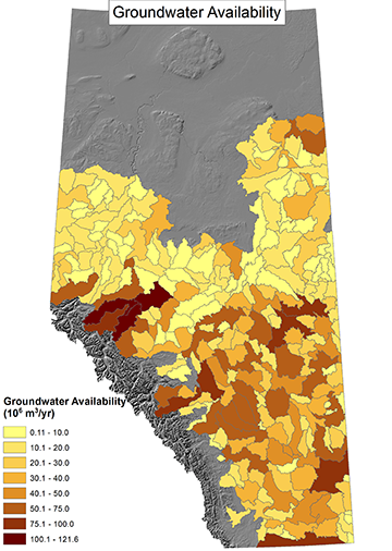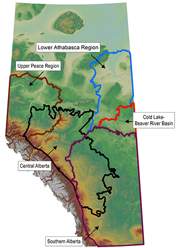
Groundwater Availability Based on Hydrologic Data
Groundwater availability is the amount of water in the groundwater system. Groundwater availability estimates are based on hydrologic data and presented at a watershed scale for non-saline resources. We adapted an approach to mapping groundwater availability based on the aquifer yield continuum concept created by Pierce et al. in 2013. This approach provides regional first-order assessments of groundwater availability in Alberta. Using the aquifer yield concept, we calculate groundwater yield within 150 m below the ground surface along a spectrum of total groundwater availability. The spectrum is bound by two extremes: nonuse and maximum mining – where nonuse represents no water withdrawn from the groundwater system and maximum mining represents all the water withdrawn from the groundwater system. To date, we have mapped central Alberta, southern Alberta, the upper Peace region, the lower Athabasca region, and the Cold Lake-Beaver River Basin.


