Our Geological Framework Program (GF Program) is designed to integrate publicly available subsurface data into a unified interpretation of Alberta’s subsurface. To do this, we gather stratigraphic picks and well log information, and then we use geomodelling techniques to build the 3D geological models. The Geological Framework refers to our set of 3D geological models representing Alberta's subsurface. These 3D geological models are built by our geoscience experts to different scales and for different purposes.
Geological Framework Program
The GF Program is a multi-year initiative that started in 2010 and evolved into a multi-disciplinary program over the years. The first prototype 3D geological model was completed in-house in 2012. This prototype had 23 geological zones and has evolved over the years to contain more than 90 zones. As of 2021, the program’s main outputs are the following types of 3D geological models and model products with different scales:
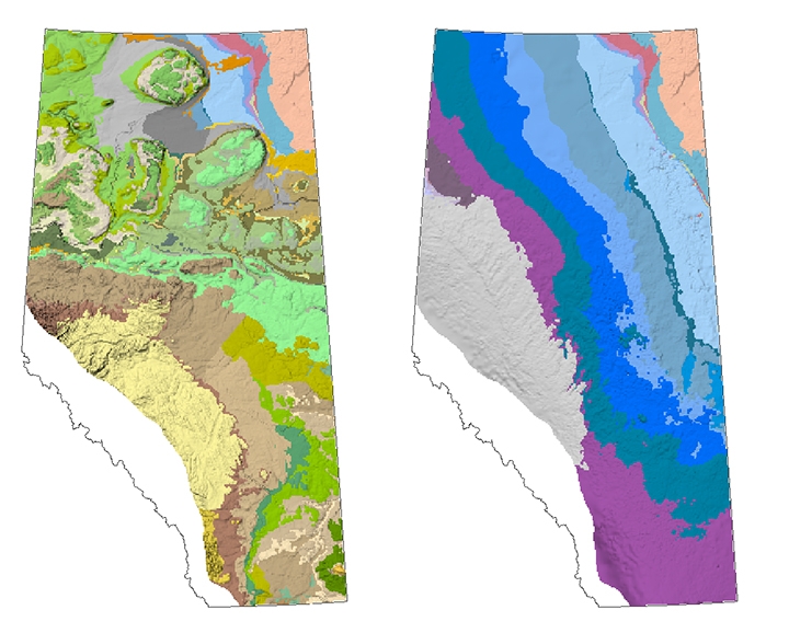
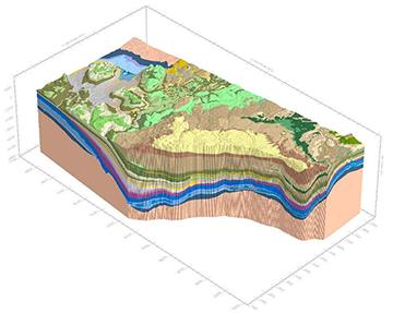
the Geological Framework of Alberta model (GFA model), which covers nearly the entire province and is updated every few years with new information
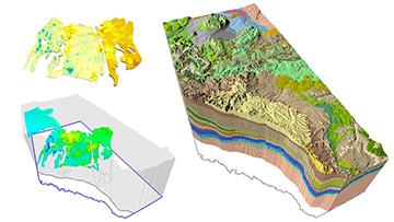
various submodels with more localized scales, including both structural and property models
model products designed for general public use, such as our Minecraft models and 3D printing files
In building some of these different types of models, we rely on our teams of multidisciplinary experts to complete data analysis and interpretations using the following set of complex steps involving expertise from across the geological realm:
interpreting new stratigraphic picks along wellbores and integrate our historical stratigraphic picks data into a picks repository
using these stratigraphic picks to model 3D representations of Alberta’s strata (model zones represent geological units within structural models, or the structural component of property models)
using outputs from petrophysical log analysis to build 3D property models for some geological units in the province, which results in higher rock property resolution within the structural model zones
The GF Program is made possible through advanced analysis techniques developed in-house by our experts. Some of these techniques are:
data science techniques to increase our efficiency in data analysis and interpretation of large amounts of wellbore data
machine learning techniques to interpolate complex model surfaces
uncertainty analysis techniques to assess the uncertainty of modelled surfaces
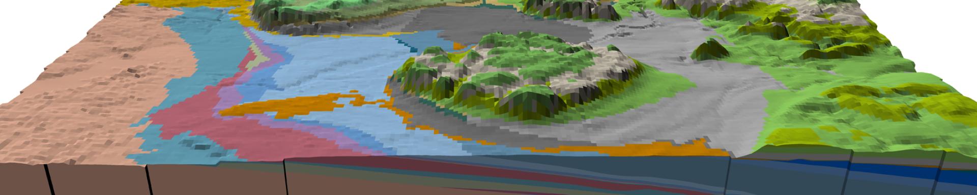
The Geological Framework of Alberta model (GFA model) is a 3D structural geomodel spanning almost all of Alberta (excluding the Rocky Mountains and Foothills) and extends to a depth of 6 km below sea level. With each passing year, our understanding of Alberta's subsurface expands, and with that comes the opportunity to update the GFA model with our latest data and interpretation. Because of this, new versions of the GFA model are released every few years. The most current version of the GFA model is GFA v3, which is published in an interactive web mapping application. As of 2022, we are working on modelling GFA v4, which will further add to the vertical resolution of the GFA model by adding new model zones.
Learn how to navigate the GFA v3 interactive web mapping application GFA v3 How-Tos
Image
We build higher resolution 3D property models for parts of Alberta’s subsurface. These models provide insight into rock properties such as porosity, permeability, water saturation, or volume of shale. These property models are used to support the Alberta Energy Regulator’s projects and regulatory decisions in areas like commingled abandonment assessments and hydrogeological studies.