Where is Ground Frozen All Year Round?

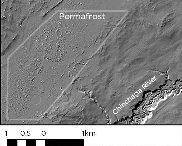
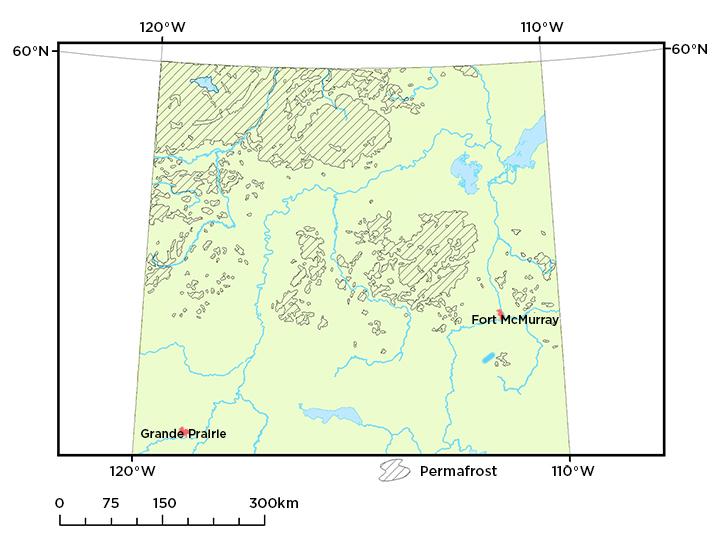
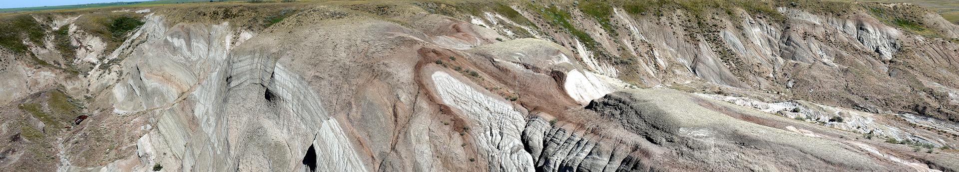
Permafrost is ground that remains below zero degrees Celsius for at least two consecutive years. It lies beneath an active layer that warms above zero degrees Celsius seasonally. Permafrost creates characteristic landforms which our experts identify and map using tools such as LiDAR imagery. It is important we understand where permafrost is in the province because permafrost influences ground stability, ecology, and surface hydrology. We identify and map permafrost in Alberta, publishing our results to aid organizations with activities like land use and reclamation planning.


permafrost-example-360px

More About Permafrost

To determine the extent of permafrost in northern (north of 56° N) Alberta, we produced a computer model using a machine-learning approach. This method incorporated field sites of known permafrost, a LiDAR-based digital elevation model (DEM), high-resolution satellite imagery, and climate data to predict the presence of permafrost. Our model showed more extensive permafrost in Alberta then previously thought. Permafrost is now known to occur further to the south in wetland areas and is insulated by a thick layer of peat.


Learn More About

Permafrost Classification Model of Northern Alberta 


In the peatlands of northern Alberta, the overlying layer of peat insulates the ice within the permafrost forming a mound within the bog. These mounds appear as a ‘bumpy’ texture in LiDAR imagery. Permafrost mounds, or palsas, form a local high of alternating layers of ice and peat/sediment. As the hydrology and subsurface materials of these mounds differ from the surrounding area, different vegetation develops. In particular, caribou lichen forms on the raised areas and thaw ponds form along the edges of palsas, leading to distinctive leaning dead black spruce in those areas.


Rock glaciers, found in alpine environments, indicate permafrost conditions. They comprise almost entirely angular rock fragments and boulders but also contain some component of permanent ice beneath the boulders that moves the rocks downslope in a similar manner to glaciers.


Cryoturbation is when sediment in soils moves during freeze-thaw cycles in soils with a mean annual temperature below zero degrees Celsius. This movement may result in patterns left on the ground over time. Sediments sorted into circles, with primarily finer grained sediment in the centre surrounded by coarser sediment (usually unvegetated), are present in upland areas of western Alberta, such as Plateau Mountain and weakly developed at Signal Mountain in Jasper National Park. Also present are solifluction lobes, which result from the downslope movement of water-saturated materials during spring melt. The front of the lobes appears as unvegetated horizontal patches.