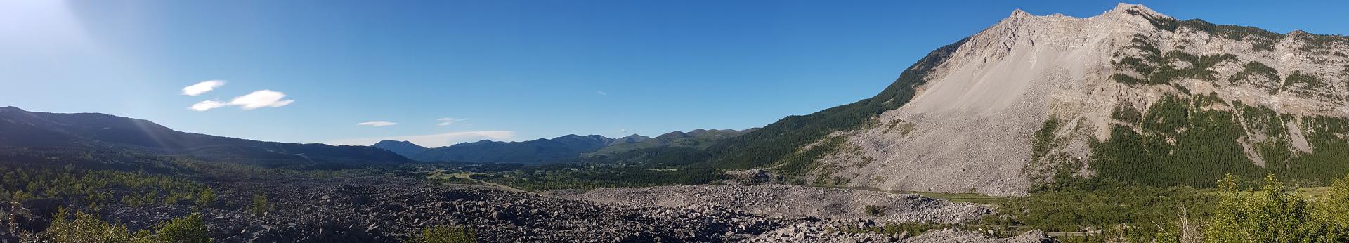
We use ground-based interferometric aperture radar (GB-InSAR) to monitor rock movements on Turtle Mountain. GB-InSAR uses radar waves to measure ground movements.
About GB-InSAR
A ground-based interferometric synthetic aperture radar (GB-InSAR) acquires images using radar antennae that travels back and forth on a fixed rail. The antenna constantly transmits radar waves towards the target area and records their return time (wave phase). These phase images are combined to measure elevation changes within a few millimetres over a very broad area. If the amount of rock or debris movement on Turtle Mountain exceeds our threshold while monitoring, we are notified of the movement.
Video file
Turtle Mountain Monitoring
In 2009, the Geotechnical Engineering Department at the University of Alberta purchased an IBIS GB-InSAR system. In September 2009, our team and the University of Alberta installed the system at the Bellevue pump house located across from Turtle Mountain. This system captured movement information from the eastern slope of Turtle Mountain.
In fall 2013, the IBIS GB-InSAR system was retired due to system failure and calibration issues.
Image
In spring 2014, we installed a similar GB-InSAR system known as LiSAmobile. This was installed at the Bellevue pump house and continues to provide us with near-real-time remote monitoring capabilities.
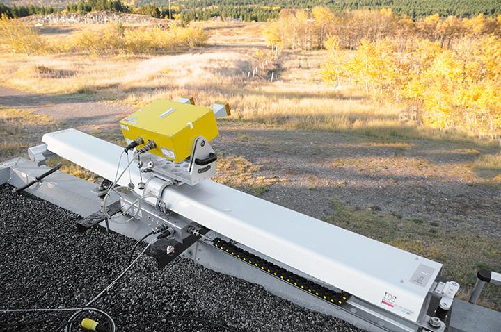
LiSAmobile is a monitoring system supplied by Ellegi Ltd. from Milan, Italy. It is made of two main parts: the radar head and mechanical components. The radar head is an active sensor that transmits pulses towards an object and receives a radar signal in return. It has of two microwave antennas: one for transmitting and one for receiving. The mechanical components include a 2.5 m long fixed track, motor, and belt system. The radar head travels back and forth along the fixed track, scanning the mountain every 8.5 minutes. A radome is fastened flush against an aluminium plate to fully enclose the system and protect it from environmental factors.
LiSAmobile is connected to the internet and data is sent to Ellegi servers for analysis. Turtle Mountain is continually scanned and evaluated, and if there is any movement outside our thresholds, we immediately receive a warning and analysis from Ellegi Ltd.
Image
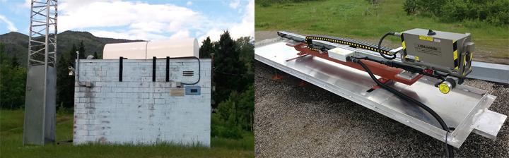
Image: LiSAmobile system at the Bellevue pump house station., LiSAmobile with radome and part of Turtle Mountain in the background, LiSAmobile GB-InSAR track and radar head.
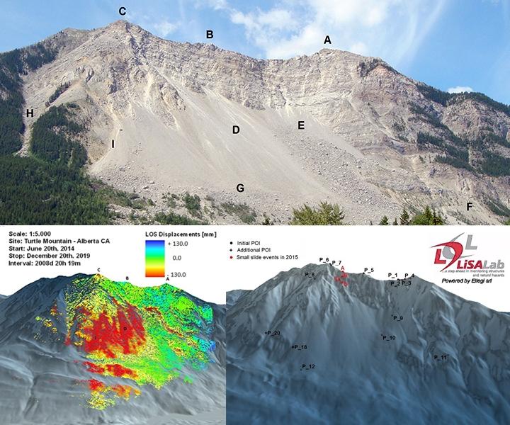
In 2014, LiSAmobile underwent a 24-hour calibration process where Ellegi identified areas of potential instability. These regions (A to G on the image below) are continuously monitored for generalized rock movements (large block rock movements). In 2020, Ellegi added two additional regions (H and I) to the study area.
Image
Image: Letters A to I denote locations of regions. Bottom right: eighteen points of interest identified since 2014.
Within each of the regions, we identified more specific points of interest (POI) for more detailed monitoring and interpretation. If necessary, we will add or remove points of interest from the study area.
LiSAmobile has been in continuous operation since installation in June 2014, except for annual 24-hour maintenance each spring. In 2020, it was out of service for 30 days when the track was returned to Italy to repair its broken belt.
Ellegi provides us with the displacement maps that depict how the slopes on the east face of Turtle Mountain are affected by slow and small movements, measured in the millimetre range. These maps are created through a collection of data over a monitoring period of 91-days (per quarter), with approximately 15-day increments. Accumulative displacement maps are produced from data collected from the start of operation until the end of current monitoring period.
On the displacement maps, both positive and negative displacement values are shown using colours. Blues indicate displacement away from a sensor (positive value), for example, rocks calving off and exposing new rock surfaces from behind. Reds indicate displacement towards the sensor (negative value), such as rocks falling and accumulating in the debris zones. Greens indicate a neutral range of displacement with minimal movements towards or away from the sensor. We monitor all displacement movements (blue, red, and green) reported by Ellegi.
Our Conclusions from Assessing LiSAmobile
We continue to use and evaluate the LiSAmobile and Ellegi’s reports. We believe the system is reliable with minimum downtime since June 2014. This service alerts us of rock movements in advance to anticipate and prepare for a potential slide, and the quarterly reports and displacement images from Ellegi analysts are consistently high quality.