Southern Alberta Groundwater Evaluation (SAGE)
A project by the Alberta Geological Survey for the Ministry of Environment and Protected Areas
About the Project
The Southern Alberta Groundwater Evaluation (SAGE) is a comprehensive three-year project (2024-2027) to advance knowledge of groundwater availability and sustainable-use conditions. The products – including new data, information, and visualization tools – will be made publicly available to communities, businesses, farmers and ranchers, and the province to improve resource accessibility and support management of this shared resource.
The SAGE Hub Site (Coming Soon)
More About Southern Alberta Groundwater Evaluation
The necessity to understand groundwater availability has been driven by various pressures, including periods of widespread drought, the water supply needs of growing communities, and economic development interests within southern Alberta. Information such as groundwater data, maps, models and other geoscience products provide the foundation for understanding groundwater availability and favourability in the region. This information is gained from existing and newly acquired, targeted data, compiled and interpreted using modern tools and technology. Teams of technical experts can then evaluate groundwater conditions and report on findings. To make this information valuable to water users and decision makers, the data and findings must be made publicly accessible, such as through maps, digital downloads and web-hosted applications.
2024)
Scope
As a basis, the project seeks to answer the following questions about groundwater resources:
- How much is available?
- Where and at what depths?
- What are the water quality (salinity, hardness) expectations?
- Will surface water and connected ecosystems be affected by development?
- How vulnerable is it to overuse (quantity) and contamination (quality)?
Crucial to this project is taking groundwater data and information products and making it available and useable by water resource decision makers and water stakeholders.
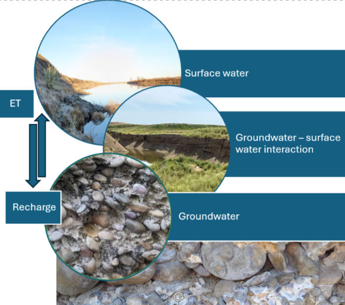
groundwater and ground surface.
The SAGE Project area footprint includes sub-basins of the Bow, Lower Red Deer, Oldman, Milk, and South Saskatchewan Rivers as well as Pakowki Lake (Figure 1). Major urban centres include the cities of Airdrie, Brooks, Calgary, Chestermere, Lethbridge, and Medicine Hat. Subsurface characterization will not include the foothills and Rocky Mountains due to the structural complexity of the thrust and fold belts they present. Sediment units included in our characterization are in descending order: surface granular, inter- or intra-granular, and basal granular materials that cumulatively form the Neogene-Quaternary principal aquifers. The principal bedrock aquifers included in our characterization are in descending order: Paskapoo, Scollard, Horseshoe Canyon, Belly River, and Milk River aquifers (Figure 2). The depth of investigation was defined as the base of the Milk River Formation, which is the deepest non-saline aquifer system in southern Alberta.
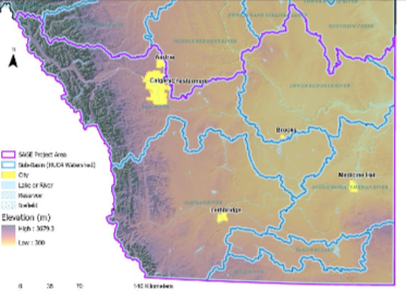
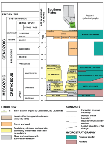
(principal aquifers) of the SAGE project area (modified
after Lemay et al., 2019). The Milk River Formation
represents the base of investigation.
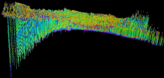
for modelling bedrock properties in a west-to-east cross-section through the project area from the
base of Milk River Formation to ground surface (S. Mei, 2026)
SAGE Project Image: Representation of upscaled logs (volume of shale rock composition) used for modelling bedrock properties in a west-to-east cross-section through the project area from the base of Milk River Formation to ground surface (S. Mei, 2026)
The process of groundwater evaluation involves various stages:
- Data acquisition, where new and existing data are acquired, digitized and integrated
- Subsurface modelling of aquifer materials, properties and distribution
- Groundwater unit (aquifer) mapping and delineation
- Characterization of mapped units based on elements such as water quality, aquifer
productivity, and connected resources (e.g. surface water, other aquifers)
New Data Acquisition
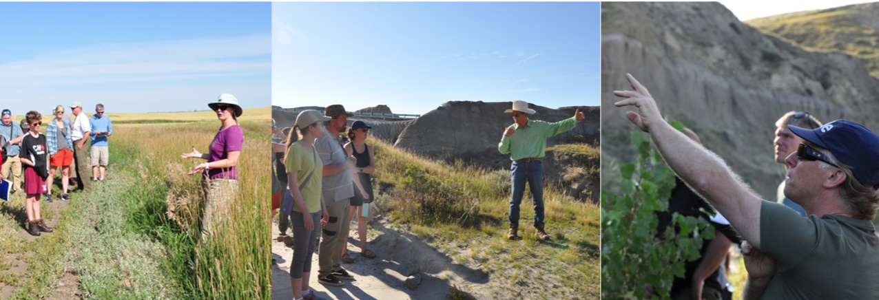
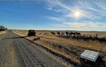
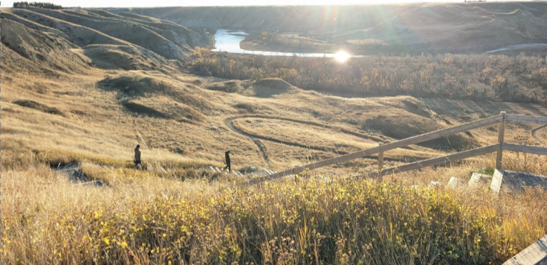
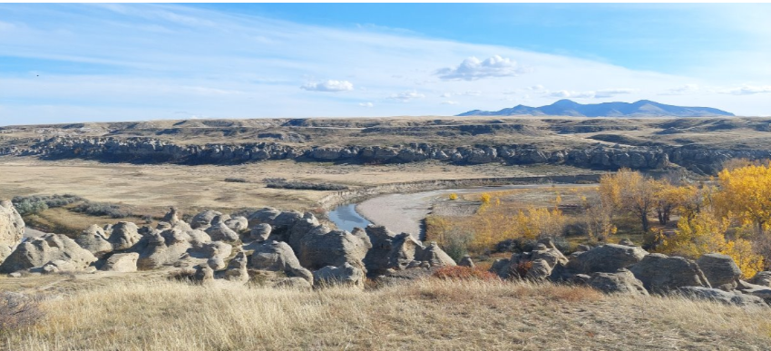
A significant effort has gone towards new data acquisition. Field sampling, monitoring and measurement including towed transient electromagnetic surveying (Photo A, by WSP Canada Inc.), synoptic surface water sampling (Photo B), Quaternary sediment logging of exposed geological sections accompanied by morphogenetic analysis (Photo C), and bedrock core logging at the Alberta Energy Regulator’s Core Research Centre in Calgary (Photo D). The Core Research Centre houses a vast archive of bedrock core collected during oil and gas drilling in Alberta.
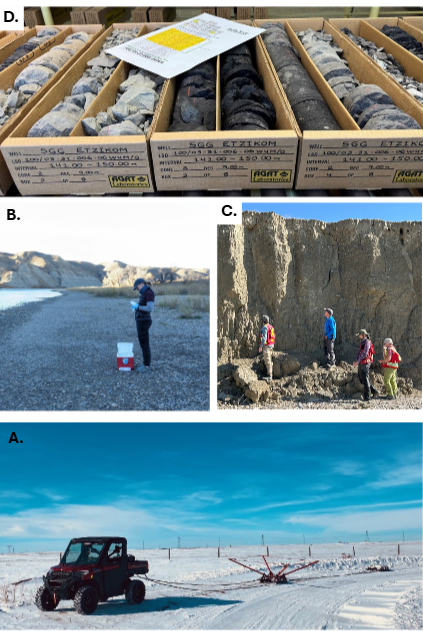
Photo A – towed transient electromagnetic surveying (WSP Canada Inc., 2025); Photo B – Synoptic river sampling (K. Pooley, 2024); Photo C – Quaternary sediment logging and morphogenetic analysis (N. Atkinson, 2025); Photo D – Bedrock core logging at the AER Core Research Centre (K. Pooley, 2026)
Outcomes from the first two years of the project include:
- New subsurface field data from 3213 linear kilometers of electromagnetic geophysical
surveys was collected to support aquifer mapping and geological characterization. - A set of 2164 existing borehole lithology logs and 879 borehole geophysical log suites were
digitized for modelling of subsurface lithology and material properties. - A new, project-wide surficial geology map (1:250,000 scale) was developed for representing
surficial materials and lithology. - A project-wide, machine-learning, predictive model was developed for the SAGE area which
estimates the probability of coarse-grained sediment in 3D for aquifer mapping and
investigation. - A 3D aquifer model for the Bassano-Gem target investigation area provided a detailed view of
groundwater-bearing sediment units helping identify where aquifers are located, how they
may be connected to surface water, and where future exploratory drilling and water supply
assessments should be focused. - A refined approach to assessing groundwater recharge was completed to incorporate
landscape variation. The new estimates were generally lower, and had narrower, more
distinct ranges for each landscape type. - An evaluation and high-resolution mapping of groundwater-recharging ephemeral wetlands in
the Pakowki Lake area confirmed the ubiquitous of these features and will support project-
scale characterization of groundwater recharge. - Two 3D bedrock property models were developed to improve understanding of the location
and movement of groundwater. The models show the composition of the rock and its
porosity, helping identify areas that may have potential for groundwater use or managed
aquifer recharge. - A review and logging of bedrock core held at AER’s Core Research Centre was conducted to
validate aquifer characteristics and property models. - A preliminary assessment of natural gas systems that reside with groundwater in bedrock
pore space was conducted . - A semi-automated groundwater unit mapping and characterization process was developed.
This process is intended to support water management decisions and exploration of new
resources. - Water sampling surveys were conducted on the Bow, Red Deer and Oldman Rivers to identify
areas of groundwater-surface water interaction for improved water management. - An Aquifer Classification System for groundwater unit delineation in Alberta was devised and
implemented as a test case. The system will provide location and subsurface diagnostics for
all major aquifers in southern Alberta. - The SAGE Hub Site and Interactive Mapping Application, which is a knowledge and mapping
GIS portal, was developed and includes visualization tools to view maps and groundwater
units.
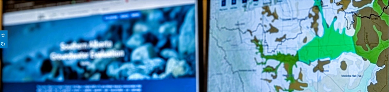
a knowledge and mapping GIS portal (A. Onojeghuo, 2026)
Making the Information Available to the Public
To make this information available to all stakeholders and the public, the project team has developed a soon-to-be public-facing, web-hosted platform and interactive map (the SAGE Hub site) that integrates project results and an extensive repository of geological and groundwater data generated and hosted by the AGS and EPA. On this site, users will also find interactive pages (StoryMaps) on SAGE geologic sites of interest and accompanying field guide, the hydrogeological regions of Alberta, and the ephemeral wetlands of the Pakowki Lake area. The SAGE project team is also actively building capacity for electromagnetic geophysical methods and the utilization of geophysics in groundwater resource exploration by meeting with various organizations and stakeholders using existing airborne and ground-based surveys.