Publication Type
Map
Authored on
Topic
Surficial Geology
Publication ID
MAP 642
Publication ID Extended
Map 642
Publication
Publication Other
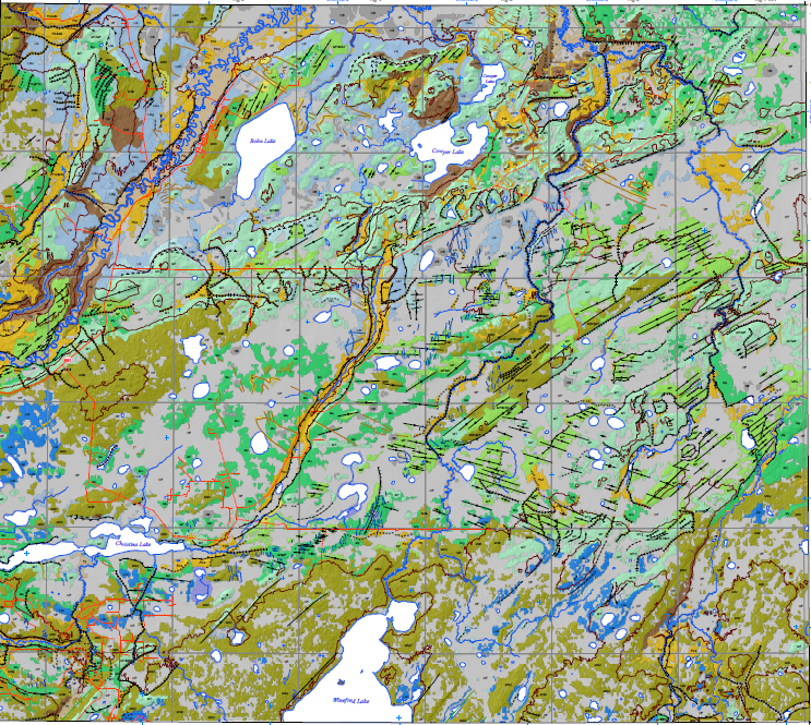
Abstract
This map depicts the surficial geology of the Christina Lake area (NTS 73M/NE) (line and area features) with legend and base-map data.
Citation
Atkinson, N. (2023): Surficial geology of the Christina Lake area (NTS 73M/NE); Alberta Energy Regulator / Alberta Geological Survey, AER/AGS Map 642 scale 1:100 000.
Preview
Place Keywords
alberta, athabasca oil sands area, bohn lake, canada, christina lake, cowper lake, winefred lake
Place Keywords NTS
73m
Theme Keywords
alluvium, colluvium, geological maps, glacial, glacial deposits, glaciofluvial deposits, glaciolacustrine deposits, mapping, maps, organic, quaternary, quaternary geology, surficial, surficial deposits, surficial geology, surficial glacial deposits, surficial mapping, till